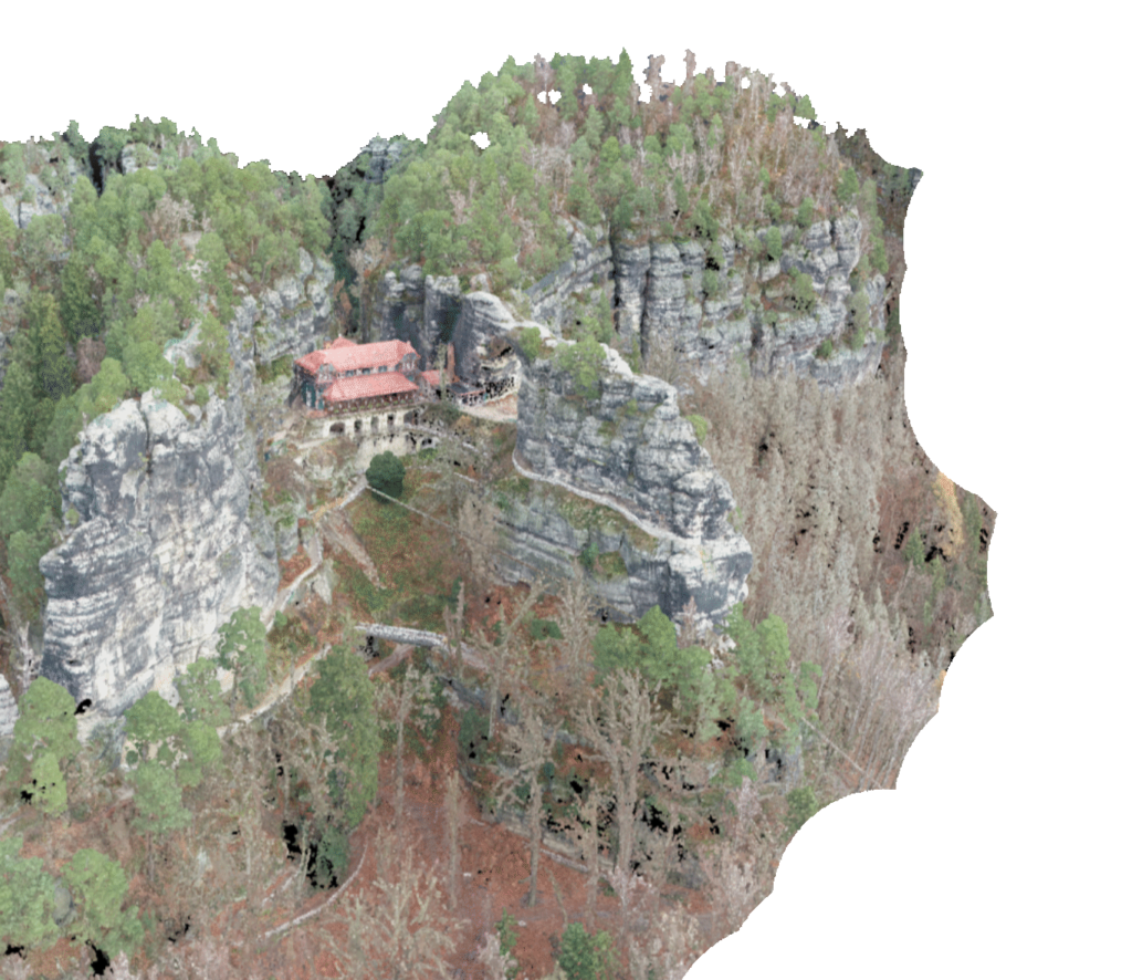
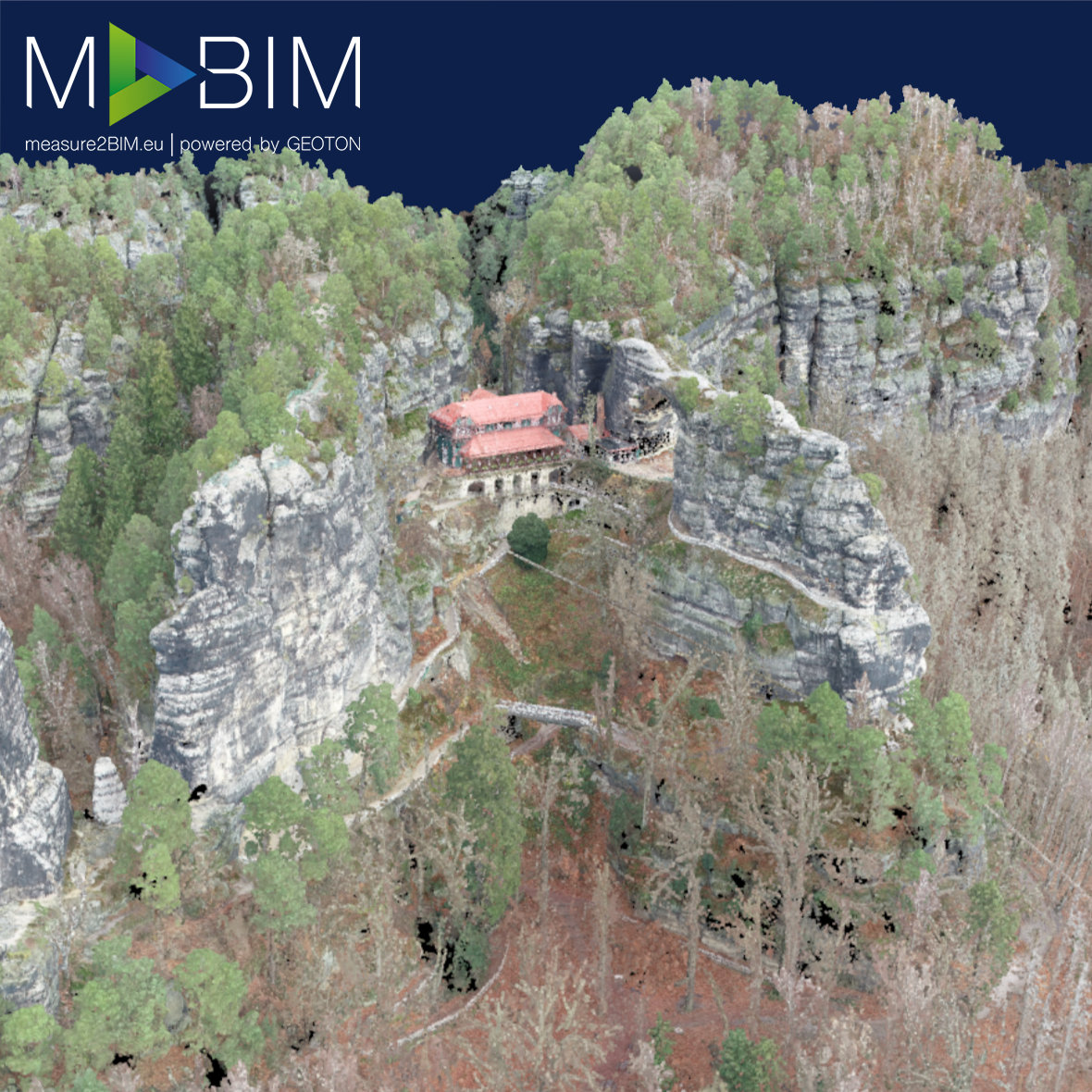
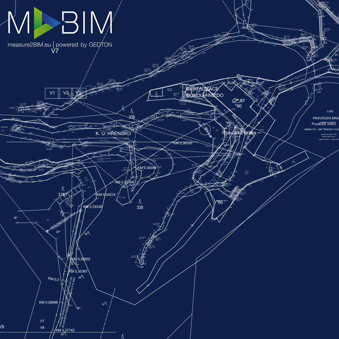
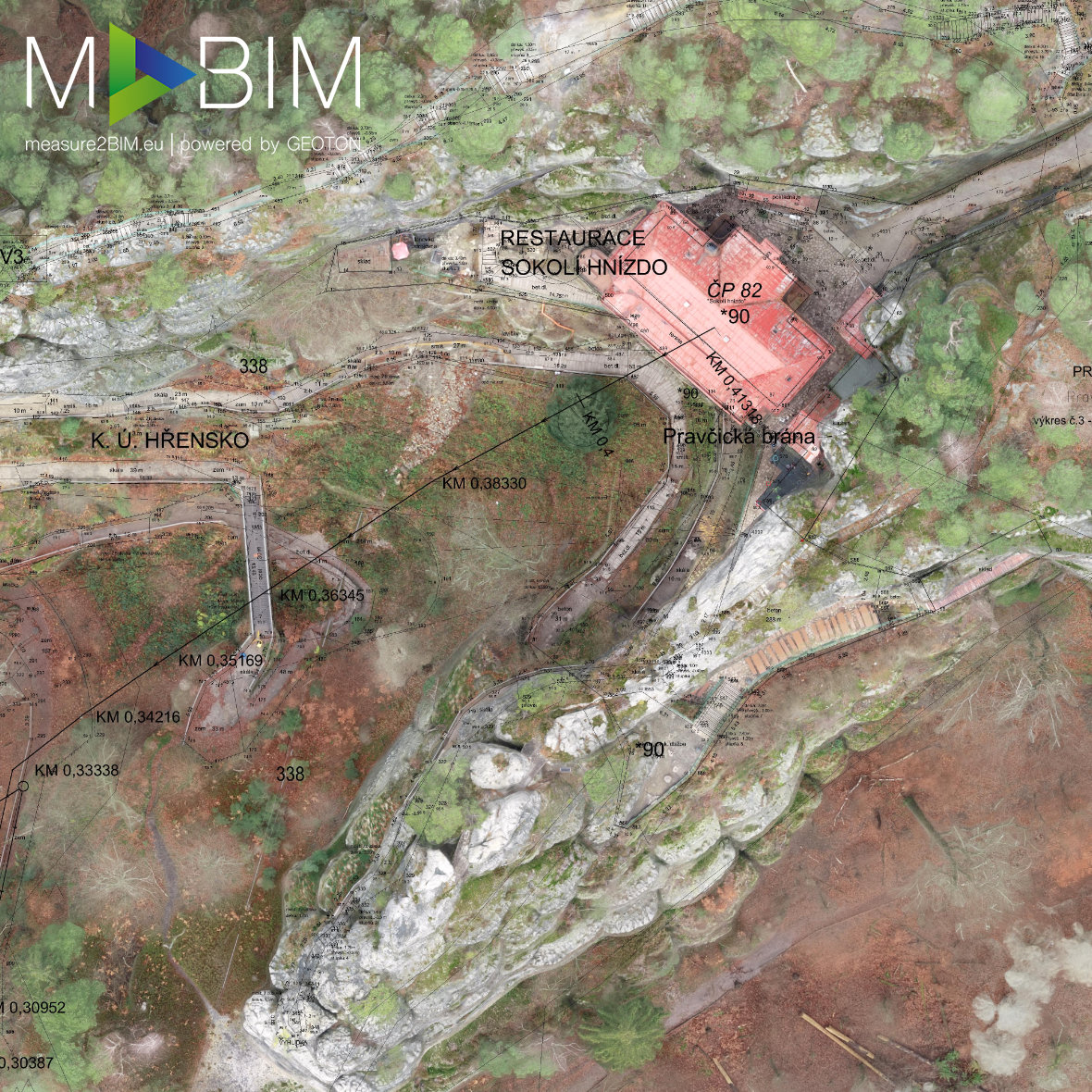
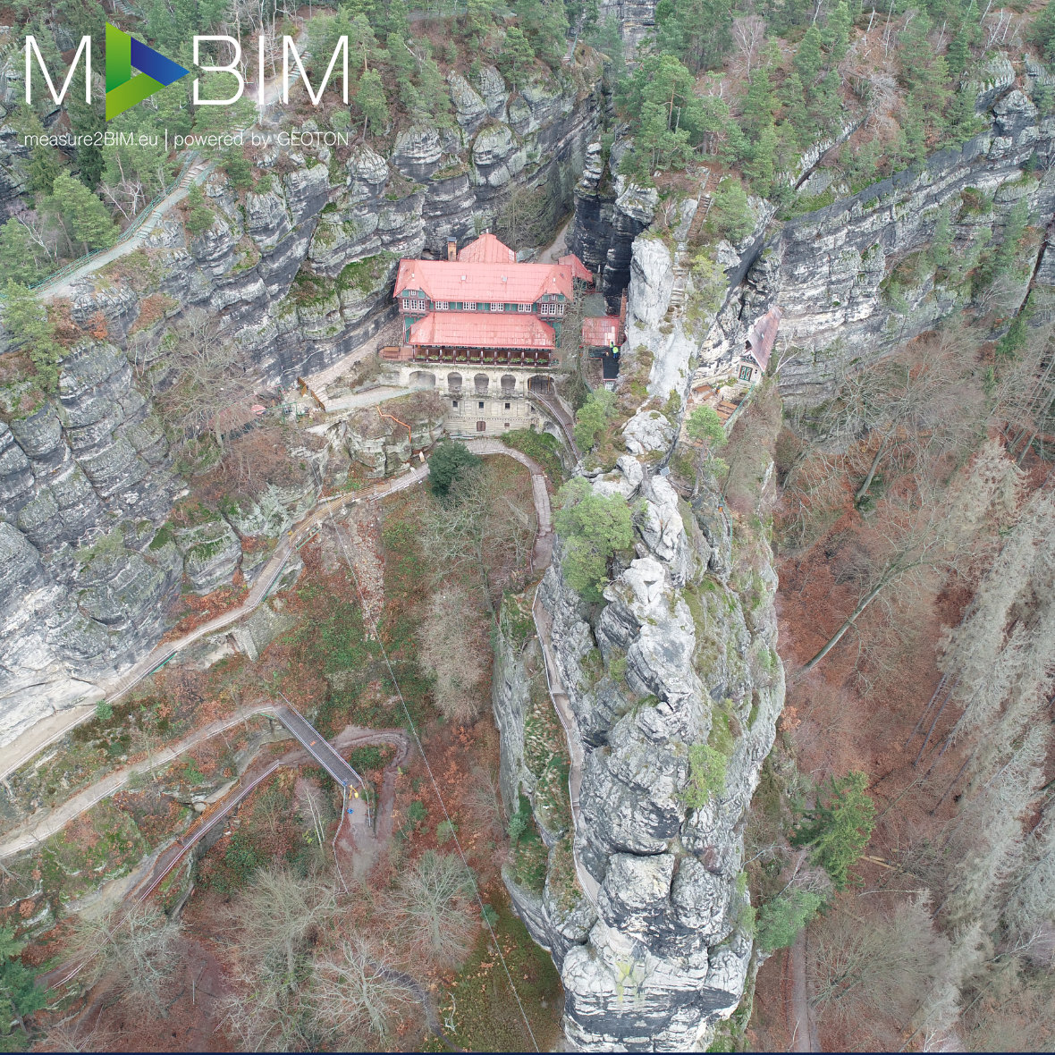
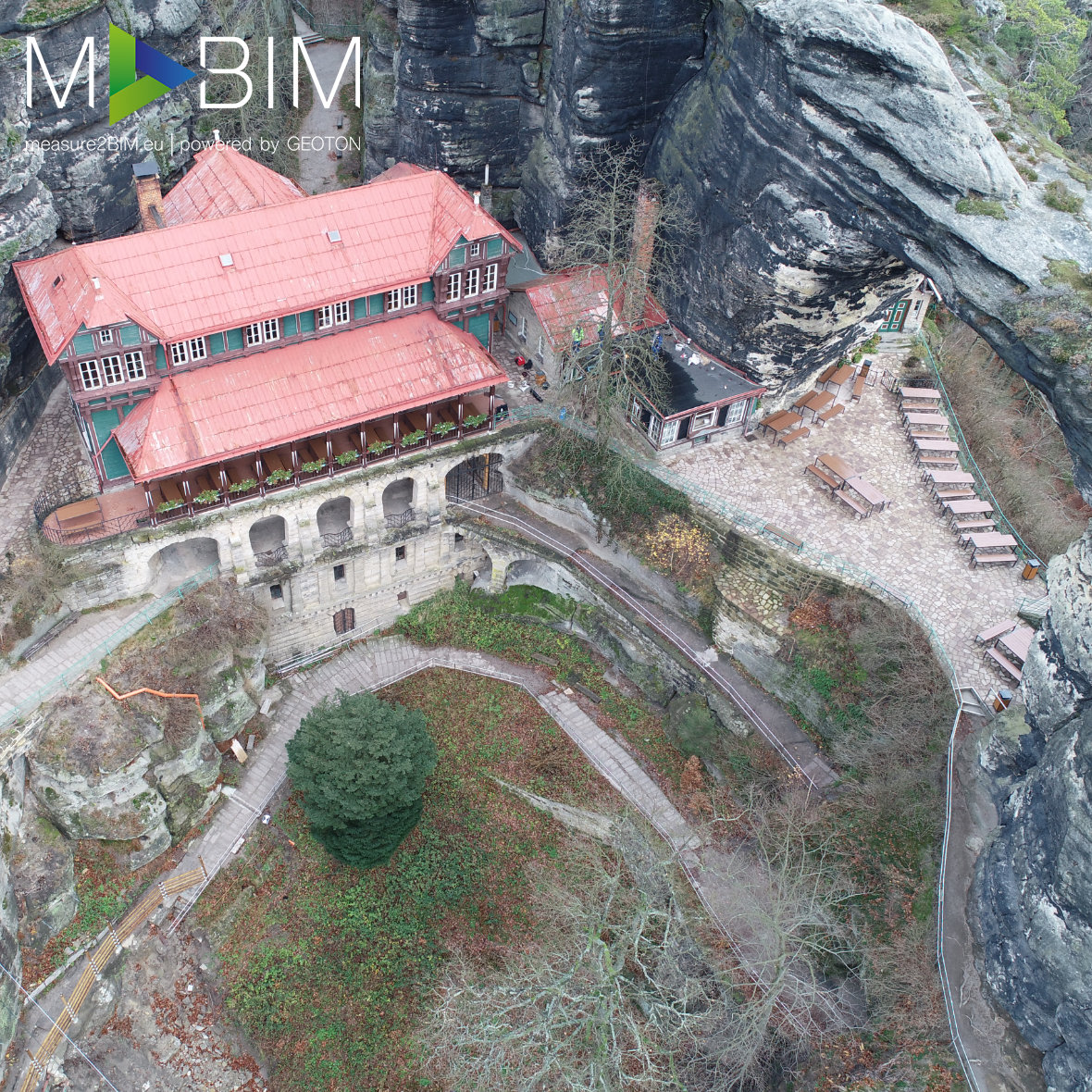
In order to survey the Pravcicka Brana, we used state-of-the-art technologies and procedures, such as aerial photogrammetry realized using a drone with an RTK antenna in combination with classic geodetic methods. Thanks to this combination of methods, we have created high-precision 3D models in the form of point clouds and a 3D textured mesh model, the accuracy and placement of which was checked using specialized surveying equipment and methods. Thanks to the use of aerial photogrammetry, we surveyed the entire object in just 2 hours. This measurement method allows survey the exterior of buildings or terrain quickly, accurately, inexpensively, and without restricting the processes on the construction site. The documentation was handed over in the form of a 3D model that can be easily linked to Autocad, Revit, or other construction software and serves as the as-built documentation for the property.
This website uses cookies for analysis purposes. By using our website, we assume that you agree to our use of cookies.
You may revoke your consent for us to store cookies at any time by deleting the cookies. Revoking your consent does not affect the legality of any processing performed on the basis of your consent prior to its revocation.