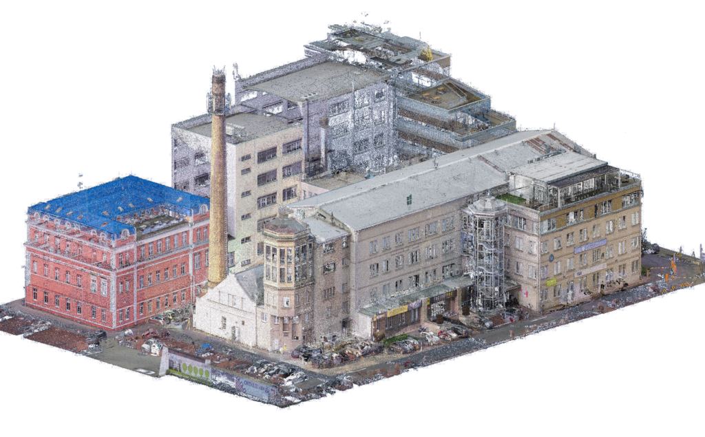
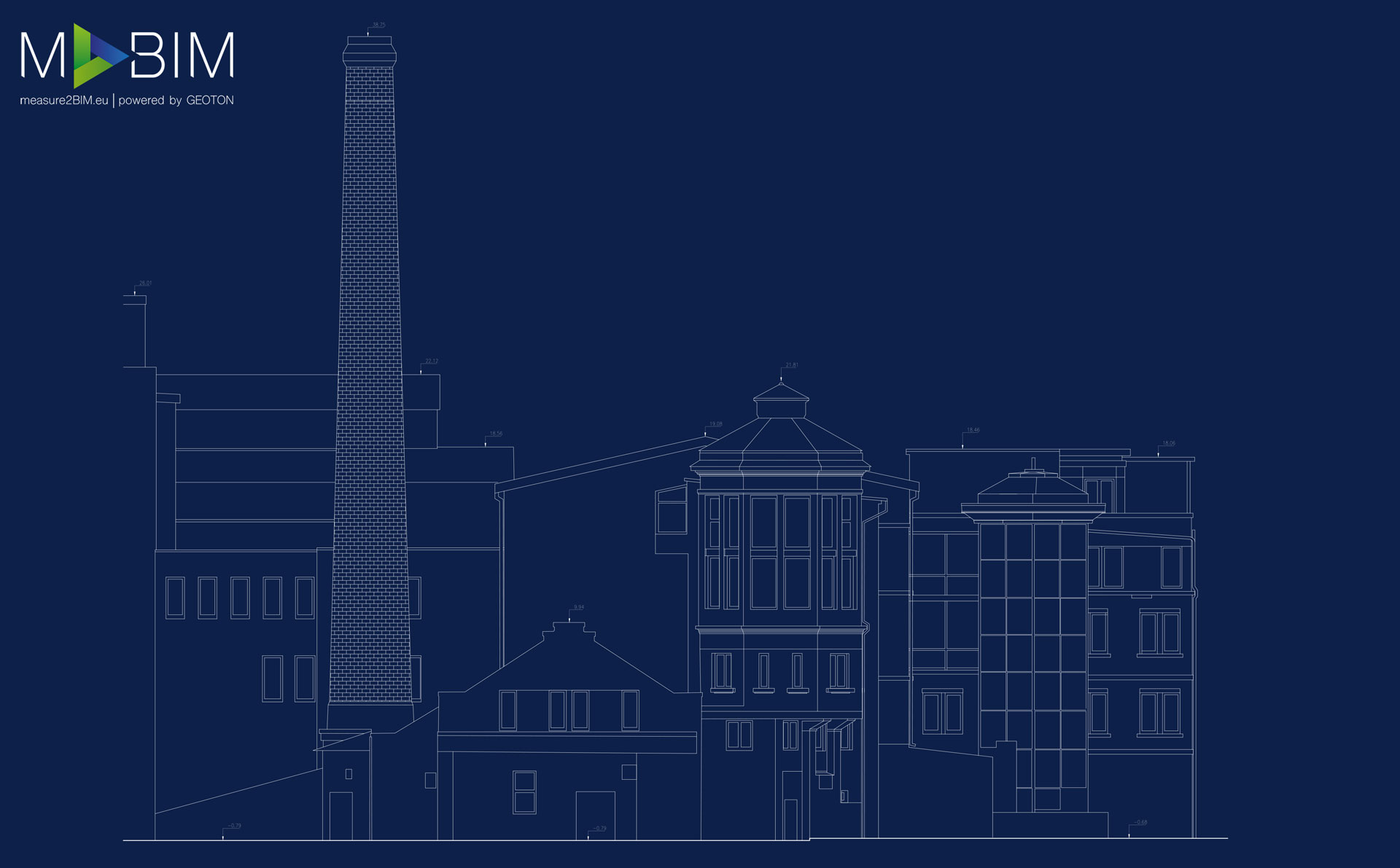
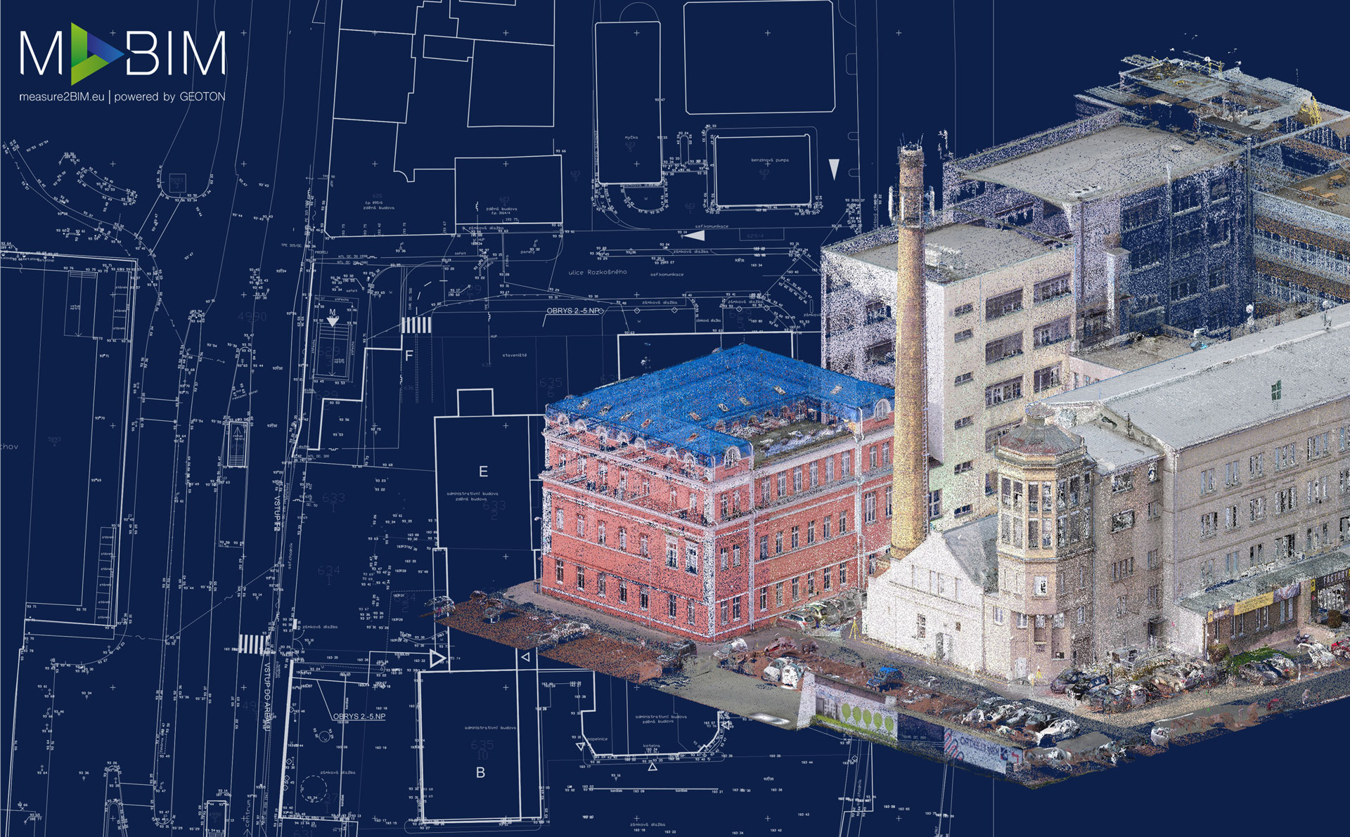
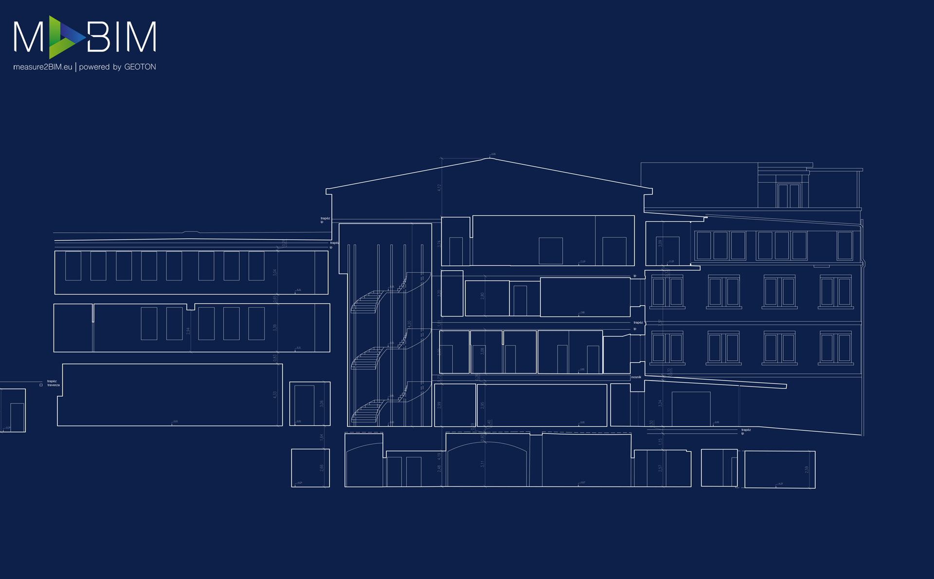
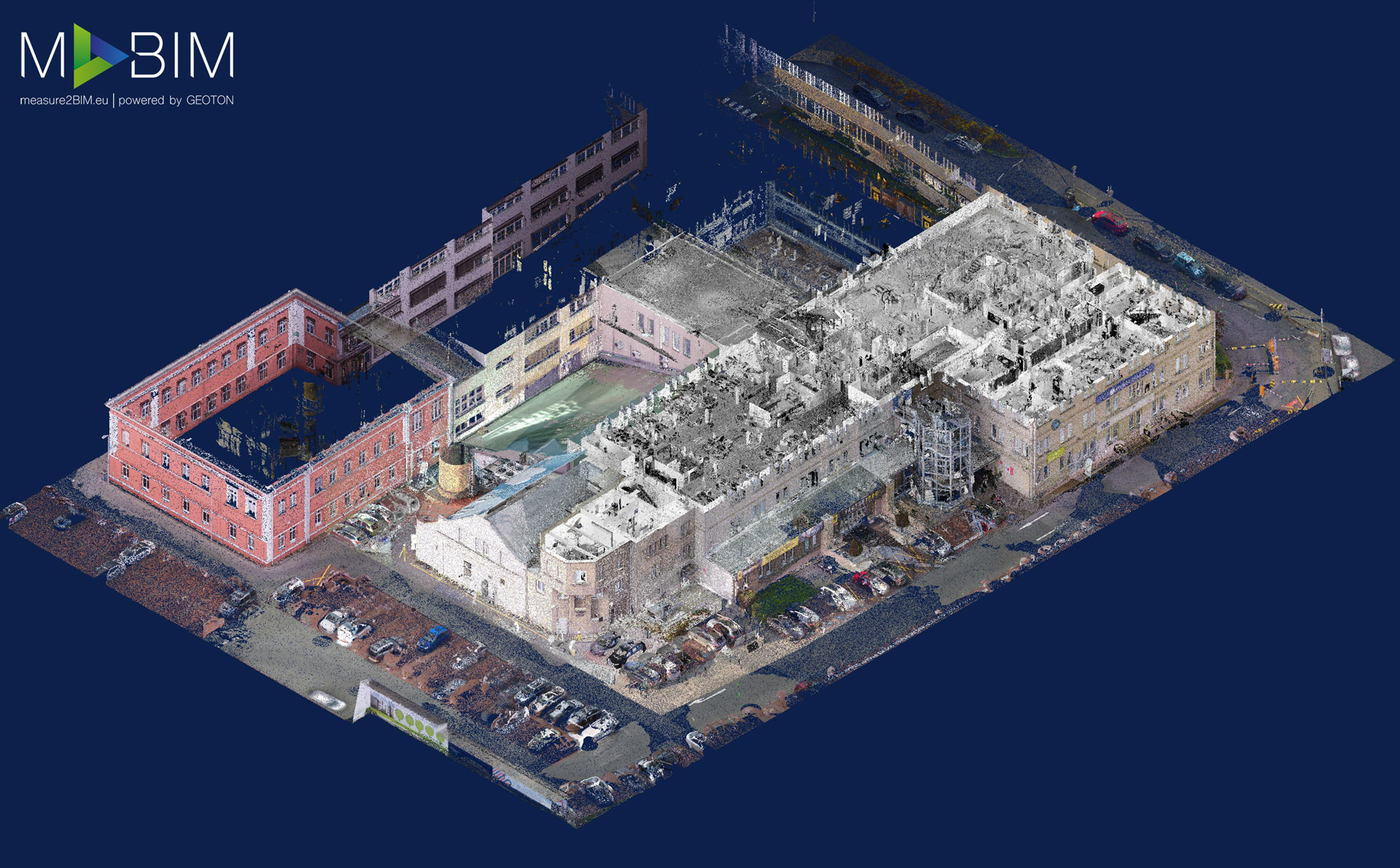
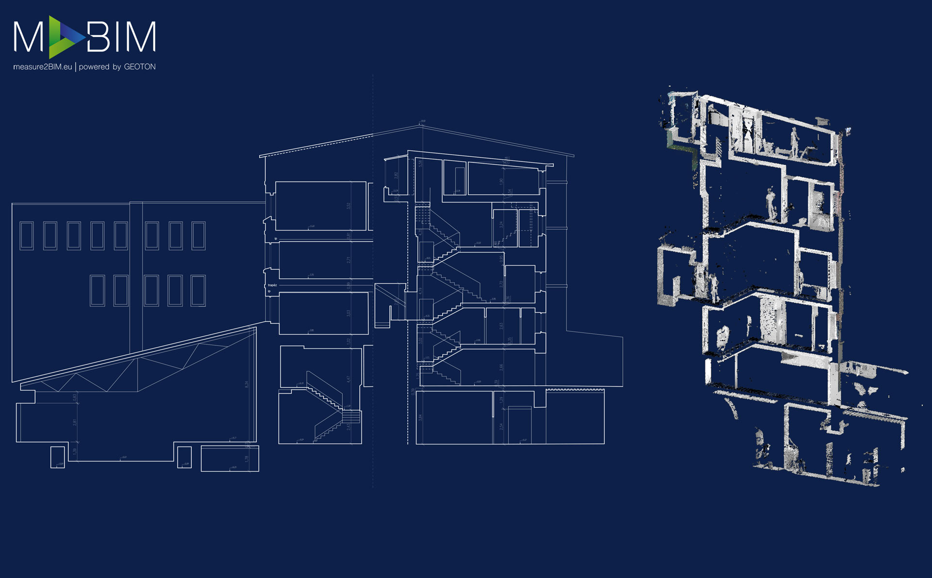
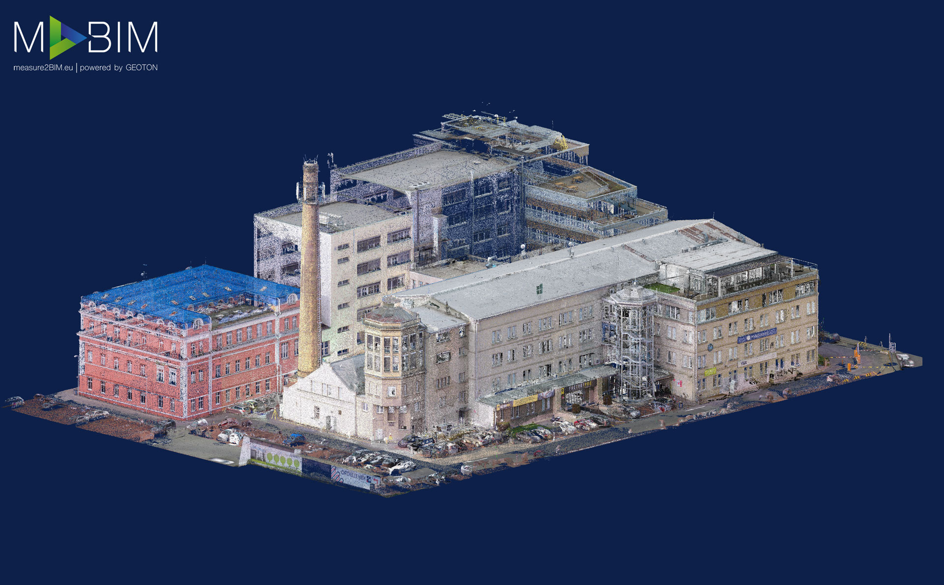
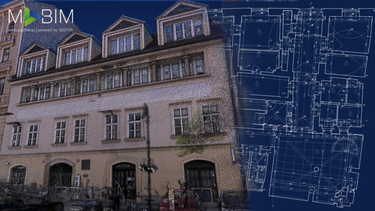
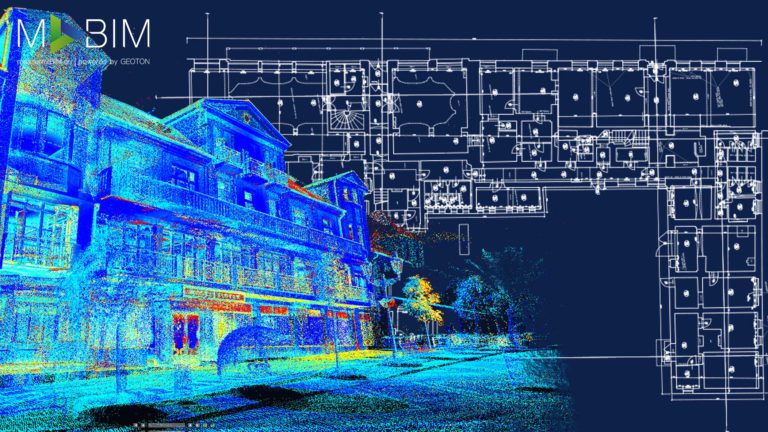
The Smíchov diary was the first project over 5,000 m², where we used technology combining aerial and ground photogrammetry with 3D laser scanning. The result of this type of survey was a 3D model in the form of a point cloud with high accuracy and high-quality colouring of the point cloud, which made it possible to create orthophoto views of the building’s facades. In addition, aerial photogrammetry in combination with stationary scanners allowed us to survey all roofs of buildings accurately. The resulting CAD (note: Bestandsdokumentation/As-Built documentation) documentation of the real state was prepared in Autodesk AutoCad and contained drawings of all floors, sectional views and views of the building’s facades. The entire survey took place while the building was in full operation, which was not limited in any way.
This website uses cookies for analysis purposes. By using our website, we assume that you agree to our use of cookies.
You may revoke your consent for us to store cookies at any time by deleting the cookies. Revoking your consent does not affect the legality of any processing performed on the basis of your consent prior to its revocation.